


Op deze presentatie in het ABC wordt het resultaat getoond van een 16 weken durend project (studio) verricht door studenten van de Amsterdamse Academie van Bouwkunst in Amsterdam. Van januari tot en met mei 2021 heeft een groep studenten in het kader van het 'Urbanism and Landscape program' gewerkt aan ruimtelijke voorstellen en ideeen voor het dynamische en complexe gebied in de regio Zuid Kennemerland (grofweg van het Noordzeekanaal tot en met de Kromme Rijn. De expositie is Engelstalig.
deelnemende studenten zijn: Coen Pronk, Enzo Dal Mas, Iaroslava Nesterenko, Jana van Hummel, Lujia Zhu, Mads Leuverink, Marleen van Egmond, Maylis Delpech, Oswin Noordergraaf, Rachel Borovská, Renan Dijkinga, Rex van Beijsterveldt, Roelof Koudenburg, Rogier Hoppenbrouwers, Romy van den Berg, Saskia Kleij, Tom van Boekel, Wout Velthof, Wouter Sibum
de studenten werden begeleid door de docenten: Huub Juurlink, Saline Verhoeven, Raul Correa Smith, Roel van Gerwen
Throughout an interdisciplinary design studio, students dedicate themselves fully to such a challenging assignment. They learn to define their own assignment and draw a future vision at a regional scale. It is a challenge to design in different scales in a consistent way: the regional scale, the ‘middle scale’ and a smaller project scale. The students learn to overthink and explore consequences in designing in different scales and answer questions like: What happens to a neighborhood when you interfere in a regional scale? For this exhibition each student presents here one board that summarizes their proposal for the region.
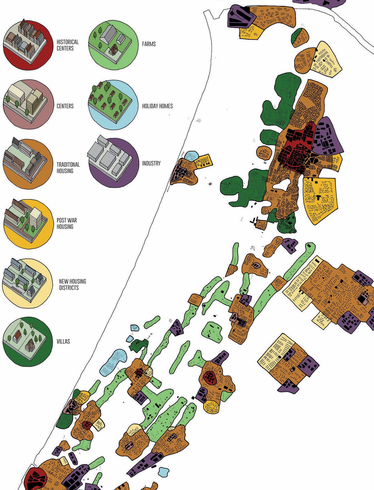
The study area the students were given is exceeding the Zeeweg by far. It covers the entire dune landscape between Noordzeekanaal and Oude Rijn, on the North-South direction, and from the beach town of Zandvoort to the Haarlemmemmer, in the West to East direction. During the first four weeks of class, all 19 students and 4 instructors worked as one research team, where students teamed up through specific themes of analysis important to better understand the region. This resulted in an Atlas with maps about a large variety of topics: from soil and geomorphological maps to urbanization, ecological maps, agricultural maps, maps about salinization, energy etcetera.
Their search went on by trying to unveil the regional identity and enhance this in their future vision in a contemporary way. A couple of common themes emerged as drivers for the proposals presented here. On the one hand, the existing, and future, threats posed by water (sea-level rise, flooding, salinization, and sweet water scarcity) became opportunities to rethink forms of energy, agriculture, and land use. And on the other hand, intricately related to water, was a common interest in ways of enhancing the quality of life and the health of humans and non-humans alike. These two themes, water, and health, were the main triggers to imagine alternative futures towards increased biodiversity, new ways to farm, to enhance local identities, and more generally to enable life to prosper while dealing with emerging challenges compounded by climate change.
Some degree of speculation was needed from the students in order to propose visions that, while not fully resolved, can provide an ambitious lens through which to imagine other ways to distribute and occupy such a fast-changing and complex region. As such the work here should be seen as snapshot scenarios of possibility, as triggers for conversation and debate regarding diverse ways to imagine futures for the region.